
2026 Annual St. Mary Parish Hurricane Preparedness Meeting
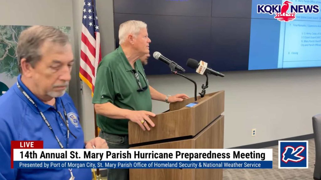
Watch the 2026 St. Mary Parish Hurricane Preparedness Meeting, presented by the Port of Morgan City, the St. Mary Parish Office of Homeland Security & Emergency Preparedness, and the National Weather Service. Streamed live by KQKI News, this marks the 14th annual presentation of the meeting.
Click To WatchCode Red Signup
Sign up for St . Mary Parish's Code Red Emergency Notification System to receive Parish Emergency alerts. Click the link below to sign up.
Code Red Sign UpNews & Updates
June 16, 2026 | Weather Alerts
Morning Update on Potential Tropical Cyclone One (PTC One) from the NHC in Miami, FL (June 16, 2026)June 16, 2026 | Weather Alerts
New event. Coastal Flood Warning from 6/17/2026 1:00 AM to 7:00 PM CDTJune 16, 2026 | Weather Alerts
New event. Tropical Storm Watch from 6/16/2026 10:10 AM CDT until further noticeJune 16, 2026 | Weather Alerts
Event extended (time). Flood Watch from 6/15/2026 10:14 PM to 6/18/2026 7:00 AM CDTJune 16, 2026 | Weather Alerts
Event extended (both time and area). Flood Watch from 6/15/2026 2:32 AM to 6/17/2026 7:00 AM CDTJune 12, 2026 | Road Closures
Road or Lane Status US 90 Eastbound from MM 162.9 to MM 163.7 near Wax Lake, St. Mary Parish, Lane ClosureJune 8, 2026 | Parish Press Releases
AMENDED AGENDA ST. MARY PARISH COUNCIL FIRST REGULAR MEETING JUNE 10, 2026 โ 6:00 PMMay 29, 2026 | Road Closures
Road or Lane Status US 90 EB overpass at LA 3211, St. Mary Parish, Lane Closure for Routine Bridge MaintenanceMay 19, 2026 | Levee District Press Releases
ST. MARY LEVEE DISTRICT NOTICE OF REGULAR PUBLIC MEETINGMay 12, 2026 | Events
St Mary Parish featured on LPBMay 8, 2026 | Road Closures
Road or Lane Status US 90 Eastbound at LA 3211, St. Mary Parish, Lane ClosureMay 8, 2026 | Road Closures
Road or Lane Status US 90 Westbound from MM 161.5 to MM 163.7, St. Mary Parish, Alternating Lane ClosuresMay 8, 2026 | Road Closures
Road or Lane Status US 90 Eastbound from MM 161.5 to MM 163.7, St. Mary Parish, Alternating Lane ClosuresMay 7, 2026 | Road Closures
Press Release (Media/Web) UPDATE: NOW OPEN: Centerville Bridge Closure Scheduled as Part of $1.56 Million Preservation ProjectMay 5, 2026 | Uncategorized
REGISTER FOR CODERED ALERTSApril 30, 2026 | Events
EMERGENCY PREPAREDNESS GUIDE 2026Social Media

โ ๏ธ ๐๐๐๐๐๐๐ ๐๐๐
๐๐๐ ๐๐๐๐๐๐๐๐ โ ๏ธ
With the potential for heavy rainfall over the next several days, ๐๐ก๐ข๐๐ ๐.๐. ๐๐๐ง๐ซ๐ฒ would like to remind residents to take time now to prepare their property and do their part to help prevent flooding issues.
Please ensure that drains around your property are free of debris to allow water to flow properly. While there is no definite forecast regarding the amount of rainfall we may receive, residents should remain alert and prepared for changing weather conditions.
As we know from past weather events, street flooding can occur quickly and may require Town officials to close roadways for public safety. If you encounter a street that has been barricaded, ๐๐ ๐๐๐ drive around the barricade even if you live on that street. ๐๐ญ๐ซ๐๐๐ญ๐ฌ ๐๐ซ๐ ๐๐ฅ๐จ๐ฌ๐๐ ๐๐จ๐ซ ๐ ๐ซ๐๐๐ฌ๐จ๐ง, ๐๐ง๐ ๐ฆ๐จ๐ญ๐จ๐ซ๐ข๐ฌ๐ญ๐ฌ ๐ฐ๐ก๐จ ๐๐ฒ๐ฉ๐๐ฌ๐ฌ ๐๐๐ซ๐ซ๐ข๐๐๐๐๐ฌ ๐ฆ๐๐ฒ ๐๐ ๐ข๐ฌ๐ฌ๐ฎ๐๐ ๐ ๐๐ข๐ญ๐๐ญ๐ข๐จ๐ง.
Additionally, motorists are reminded to use extreme caution when driving through areas with standing water. Anyone observed operating a vehicle at excessive speeds or driving recklessly through flooded streets may be issued a citation and/or face arrest when appropriate.
These precautions are in place to protect lives, property, and emergency responders. We appreciate everyone's cooperation and patience as we monitor weather conditions and work together to keep our community safe.
Stay informed, stay prepared, and stay safe.
๐๐ฑ๐ฒ๐ฎ๐ฏ ๐.๐. ๐๐ฎ๐ท๐ป๐
๐๐ฎ๐ป๐๐ฒ๐ฌ๐ด ๐๐ธ๐ต๐ฒ๐ฌ๐ฎ ๐๐ฎ๐น๐ช๐ป๐ฝ๐ถ๐ฎ๐ท๐ฝ

Key Messages for Disturbance Over the Northwestern Gulf of America
8:00 AM EDT Tue June 16, 2026
1. NHC continues to monitor a disturbance that is forecast to move along the northwestern Gulf coast through Wednesday. The system could become a tropical storm, and interests along the northwestern Gulf Coast should continue to monitor updates to the forecast.
2. Regardless of tropical cyclone formation, interests across southern and eastern Texas and portions of Louisiana and Mississippi should prepare for periods of intense rainfall over the next several days which could produce widespread, life-threatening flash, urban, and river flooding. Gusty winds and coastal flooding are also possible along portions of the northwestern Gulf Coast.
3. Tropical storm watches or warnings could be required for portions of the northwestern Gulf Coast later today. Stay up to date with the latest at hurricanes.gov and weather.gov.


