
October 7, 2026 | Weather Alerts
UPDATE FROM STATE CLIMATOLOGIST, JAY GRYMES
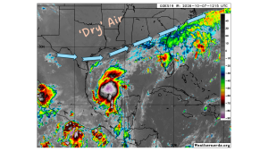
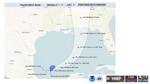
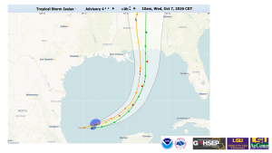
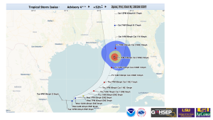
Wednesday 11 AM Tropical Update: TS Isaias
Opinions/comments are mine … federal weather expertise is housed at the NHC and LA’s local NWS offices. Stay informed with your local media experts.
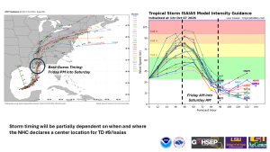
TS Isaias (“ees-ah-EEE-ahs”) appears headed for the central Gulf Coast. Strengthening is expected over the next 2 days with the NHC calling for Isaias to reach Category 2 while over the Gulf.
There remains enough track uncertainty to keep a close eye on the storm track for the next couple of days … but it appears as though significant impacts are unlikely for the Bayou State.
We continue to watch the position and presence of ‘dry’ air and wind shear in the region as Isaias gets closer to landfall: there is some suggestion that the storm could weaken slightly before landfall due to one or both of these atmospheric factors.
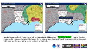
Plaquemines Parish could see tropical-storm force winds on Friday. NWS/Slidell (LIX) points out that there is still a low-end potential (less than 20%) for hurricane-force winds to extend into portions of southeastern Louisiana.
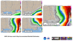
Isolated downpours will be possible — mainly over SE Louisiana — should rainbands successfully wrap around the northwestern and western circulation, but even then, most of the state will receive than 0.5″ of rain for the event. LIX also notes that the tornado threat, while very low, is not ‘zero’ for the SE parishes.
Thanks:
National Hurricane Center (NHC)
NWS offices serving LA: SHV, JAN, LCH & especially LIX
WeatherNerds.org
WeatherModels.com
GOHSEP & LSU