
September 4, 2026 | Weather Alerts
UPDATE FROM US NWS LAKE CHARLES SLACK CHANNEL 9.4.26
NWS – Lake Charles – Cam Kowalski [6:59 AM]
Good day Partners. As per last night’s 04th/00Z upper air analysis indicates, PWATs continue to remain toward or above the 90th Percentile.
That suggests developing convective showers and thunderstorms will have the opportunity to produce excessive rainfall today through Sunday
morning. Latest convection guidance shows much of this activity being diurnally driven as the atmosphere destabilizes through the late morning
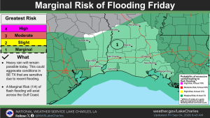
into the afternoon hours. At the present time of this post, we are currently in Marginal Risk (Level 1 out of 4) for excessive rainfall that may lead
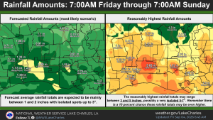
to instances of Flash Flooding. Average rainfall amounts look to range 1 – 2 inches through 7AM Sunday. However, pockets of heavier rainfall do
show up when looking at the 90th+ Percentile QPF. As we have seen previously in this humid air mass, some of these storms can be capable
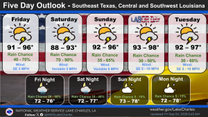
of 2-4+ inch per hour rainfall rates. Moderate to high rainfall chances stay in the forecast through the Labor Day weekend with light southerly
winds and temperatures ranging in the upper 80’s to upper 90’s moving through the weekend into the following work week.