
August 27, 2026 | Weather Alerts
TS DOLLY UPDATE FROM STATE CLIMATOLOGIST, JAY GRYMES 8.27.26
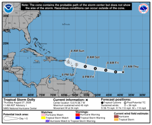
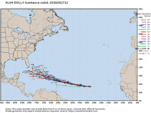
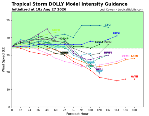
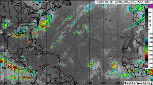
S Dolly Update: 3PM Thursday.
Comments are mine … the NHC and Louisiana’s NWS Forecast Offices house the federal weather expertise.
BLUF for Gulf interests:
As the NHC explains in its 10AM Discussion, “All of our guidance is showing Dolly opening up into a strong tropical wave before it reaches the Leeward Islands, which is our expectation as well …”
Note that the NHC forecast cone only runs through Sunday morning (3 days) rather than the typical 5-day stretch, reflecting the NHC’s expectation that Dolly will succumb to wind shear and dry air. In fact, the NHC has Dolly losing its tropical characteristics before reaching the Lesser Antilles this weekend.
Looks like El Niño may be doing its job? (And thank you for that.)
A tropical wave located east of (behind) Dolly will need to be watched … with another disturbance looking to exit the African coast in the next couple of days. It is the end of August, and the “wave train” is rolling.
Courtesy:
NOAA/NWS National Hurricane Center (NHC)
WeatherModels.com
WeatherBELL.com
TropicalTidbits.com
WeatherNerds.org