
August 31, 2026 | Weather Alerts
TROPICAL UPDATE FROM STATE CLIMATOLOGIST, JAY GRYMES
Monday AM: Tropics Update
Opinions are mine … the federal tropical expertise is housed in the NHC and the local NWS offices serving Louisiana. Also, be sure to follow qualified media and professional meteorologists.
Well … that changed quickly.
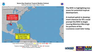
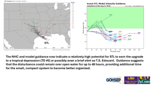
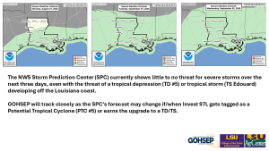
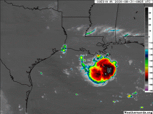
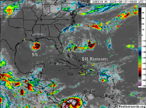
The NHC has upped development chances for Invest 97L significantly … now with good chances of becoming a tropical depression (TD #5) or even a tropical Storm (TS Edouard).
Don’t be surprised to see 97L get tagged as Potential Tropical Cyclone #5 (PTC-05) later today … remember, that allows the NHC to post Watches and/or Warnings along portions of the Louisiana and Texas coasts even before the system gets an official upgrade.
This 97L/PTC-05/TD#5/TS Edouard looks to be a slow-mover and could remain over water for another 48 hours before making a landfall. The most likely landfall looks to be along the upper Texas Coast … but Cameron Parish remains a possibility.
Fortunately, the system remains rather compact and hopefully stays that way. That should help to minimize the overall impact of this system regardless of its stage of development over the next 2 days.
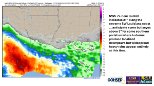
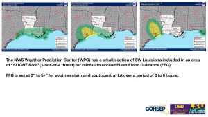
We will want to keep a guard up for localized strong t-storms: excessive downpours and nuisance flooding can’t be ruled out but widespread heavy rains appear unlikely. For now, storm surge looks to run less that 5ft for just about the entire Louisiana coast and under 3ft for much of the coastline. While we could see some inland gusts reaching low-end tropical storm strength, most of the stronger winds will likely miss the coastal parishes.
Courtesy & Thanks:
National Hurricane Center (NHC)
NWS Forecast Offices serving Louisiana: SHV, JAN, LCH & LIX
TropicalTibits.com
WeatherNerds.org
WeatherBELL.com
WeatherModels.com
GOHSEP & LSU