
TROPICAL UPDATE FROM US NWS LAKE CHARLES 7 AM 9.2.26
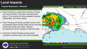
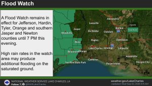
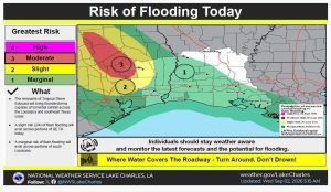
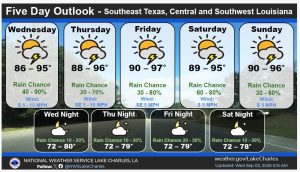
The remnants of Edouard are centered over Polk County, Texas. Overnight the system slowed while a band of very heavy rain trained across portions of southeast Texas, most notably over Hardin and Tyler Counties. Storm totals from the past 18 hours is from around 15 to 22 inches between Kountze, Honey Island, Village Mills, and Hillister. Edouard has resumed a northward trek at around 5 mph which is allowing the band of heavy rain to lift north and out of the hardest hit area, however a few more inches of rain is plausible. Village Creek and other surrounding streams may rise through the next couple of days as flood waters drain. Additional showers and storms will be possible through the afternoon, therefore the flash flood watch has been extended until 7PM this evening over portions of SE TX. Elsewhere across southwest and central Louisiana, scattered to numerous afternoon storms will be possible, but the threat of flash flooding is lower. Through the rest of the week and into the weekend afternoon thunderstorms can be anticipated.
Take care.
Andrew Tingler