
TROPICAL UPDATE FROM US NWS NEW ORLEANS/BATON ROUGE 10 AM 7.20.26
NWS – New Orleans – Megan Williams [10:18 AM]
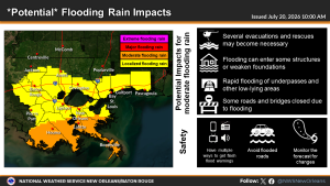
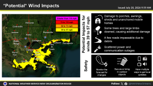
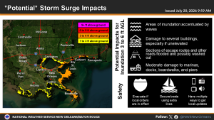
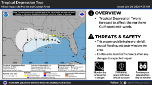
For the winds, generally expecting the potential for tropical storm force wind gusts for southeast Louisiana south of Lake Pontchartrain and coastal MS south of the I-10/12 corridor. A Tropical Storm Watch is in effect for the immediate LA/MS coastline east of the mouth of the MS River.For the surge, we are expecting 2-4ft of inundation along and east of the mouth of the MS River and 1-3 ft of inundation along and west of the mouth of the MS River, including Lakes.For rainfall, expecting 3-5 inches with locally higher amounts possible, especially along the southeast LA coast.No threat of tornadoes at this time.
And as far as timing, the earliest reasonable time of arrival for tropical storm force winds is generally Tuesday evening/Wednesday morning. The most likely time of arrival for tropical storm force winds is Wednesday morning through Wednesday evening.