
August 13, 2026 | Weather Alerts
TROPICAL UPDATE FROM JAY GRYMES, STATE CLIMATOLOGIST 8.13.26
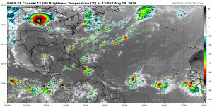
Tropics Watch: Thursday Mid-Day
Check with the federal experts at the NHC and the four NWS Field Offices serving LA: LIX, LCH, JAN & SHV
Opinion/comments here are mine … and do not necessarily represent those of GOHSEP or LSU.
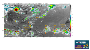
No significant changes or increase in threat for the Bayou State . . . for now. However, it is mid-August, and the wave train is rolling off Africa as evidenced in the satellite image.
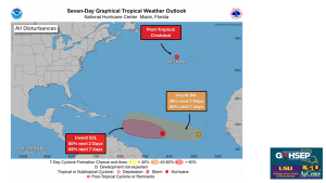
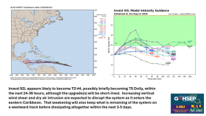
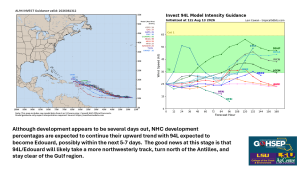
Invests 92L and 94L continue to churn in the tropical Atlantic: both will likely earn NHC ‘upgrades’ but neither appears to be a threat for the Gulf region.
92L is expected to briefly become a tropical depression (TD #4), possibly even get a (very) short stint as TS Dolly, but could dissipate while moving east-to-west across the Caribbean. 94L development seems likely several days down the road, potentially becoming Edouard, but taking a turn that keeps it over the open Atlantic.
Thanks/Courtesy:
NOAA/National Hurricane Center (NHC)
NWS Offices serving Louisiana: SHV, JAN, LCH & LIX
WeatherModels.com
TropicalTidbits.com
WeatherNerds.org