
October 2, 2026 | Weather Alerts
UPDATE FROM STATE CLIMATOLOGIST JAY GRYMES 10.2.26
FINALLY: Bringing Rain into the Forecast: Friday AM
Comments/opinions are my own … the NWS houses the federal weather expertise.
Also remember to check with your local qualified media meteorologists.
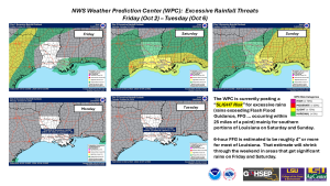
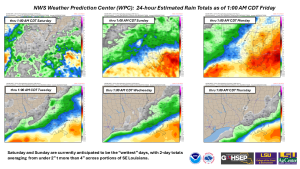
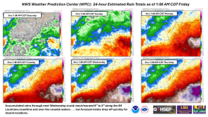
Rain finally returns to the short-to-medium outlook, especially for the southern part of the state. Rains of 1″ to 4″ near and south of the I-10/12 corridor should put at least a dent in drought conditions for much of that portion of the state.
Severe storms are not a significant concern with the expected rain around the Bayou State, although isolated strong/severe storms cannot be ruled-out, especially for Saturday and Sunday. The “wet” forecast has prompted cancellations/postponements of some outdoor events this weekend but neither day is anticipated to be an all-day wash-out.
Unfortunately, most of the northern half of Louisiana will get less than 1″ of rain over the next few days … that may be enough to halt the recent trend of drought intensification for many northern parishes but will not be sufficient for notable improvements in soil moisture.
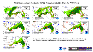
A sequence of fronts will take advantage of a recent increase in regional atmospheric moisture and keep the weather unsettled into next week along the coast. But the rains will exit northern Louisiana by late Sunday/early Monday.
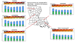
The other storyline here is the forecast for an extended run of days without highs reaching the 90° after today (Friday).
Thanks to:
NWS offices serving Louisiana: SHV, JAN, LCH & LIX
NWS Weather Prediction Center (WPC)
NWS Storm Prediction Center (SPC)
WeatherModels.com
GOHSEP & LSU