
August 14, 2026 | Weather Alerts
TROPICAL UPDATE FROM JAY GRYMES, STATE CLIMATOLOGIST 8.14.26
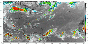
Tropics Watch: Friday AM
Opinions/comments are mine … and do not necessarily represent those of GOHSEP or LSU.
Check with the federal experts at the NHC and the four NWS Field Offices serving LA: LIX, LCH, JAN & SHV.
No significant changes or increase in threat for the Bayou State for now.
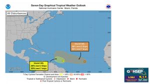
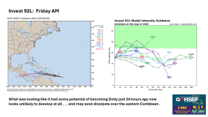
Invest 92L: what looked like it might(?) become Dolly a day or two ago now looks more likely to be ‘nada’ in the upcoming days. Such are the vagaries of tropical waves traveling through dynamic and sometimes hostile atmospheric environments.
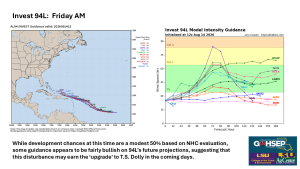
Invest 94L: The NHC is giving this wave just a 50% chance for development over the next 7 days as of this morning. Model runs are also sending mixed reviews. Regardless of development, this system does not appear to be headed in the direction of the Gulf … for now.
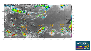
Waves continue to roll off of Africa and into the eastern tropical Atlantic, but thus far, wind shear and ‘dry’ air continue to win the day.
Thanks/Courtesy:
NOAA/National Hurricane Center (NHC)
NWS Offices serving Louisiana: SHV, JAN, LCH & LIX
WeatherModels.com
TropicalTidbits.com
WeatherNerds.org
Jay Grymes
State Climatologist
Cell: 225-505-6916